Getting Around Kyoto: A Complete Transport Guide for Travelers
Navigate Kyoto seamlessly with expert advice on bypassing bus congestion, utilizing the efficient subway and rail network, and choosing the perfect transport mode. This guide is built to help travelers avoid common traps, save time, and experience the city like a true local.
Getting Around Kyoto: A Complete Transport Guide
Kyoto rewards travelers who know how to move through it. The city blends ancient streetscapes with one of Japan's most efficient transit networks, making navigation surprisingly straightforward once you understand the layout. Whether you're hopping between temples in Higashiyama or cycling through Arashiyama's bamboo groves, choosing the right transport mode transforms a good trip into a seamless one.
Understanding Kyoto's Transport Landscape
Kyoto sits in a basin surrounded by mountains on three sides, with the city center spreading across a mostly flat grid. This geography makes the southern and eastern districts highly walkable, while the northern and western areas require more deliberate planning. The public transport system reflects this: subways handle the core north-south and east-west corridors, trains connect to outlying districts and neighboring cities, and buses fill the gaps with staggering thoroughness.
The key to moving well in Kyoto is matching your transport to your destination rather than defaulting to one mode. Trains and subways outperform buses on speed and comfort, but buses reach corners of the city that rail cannot. Taxis make sense for groups or awkward connections. And for shorter distances, walking or cycling often beats waiting for transport entirely.
Trains: The Backbone of Regional Travel
Six rail lines serve Kyoto, ranging from local city circuits to intercity bullet trains. For visitors, the most relevant lines are:
- JR Sagano Line – Reaches Arashiyama (Saga-Arashiyama Station) and connects toward Kobe and Osaka
- JR Nara Line – Direct access to Fushimi Inari, Uji, and Nara
- Keihan Main Line – Runs along the eastern edge of the city, ideal for Higashiyama and southern destinations
- Hankyu Kyoto Line – Connects downtown Kyoto (Kawaramachi) to Osaka's Umeda district
- Eizan Electric Railway – A charming local line from Demachiyanagi to the mountain villages of Kibune and Kurama
Most private rail lines in the Kansai region now accept contactless credit card payments at the gates, eliminating the need to buy individual tickets for casual rides. For frequent travel, IC cards (ICOCA, Suica, or PASMO) remain the most convenient option.
Subways: Fast Cross-City Transit
Kyoto's subway system is modest but strategic. Two lines intersect at Karasuma-Oike Station in the city center:
- Karasuma Line (Green) – Runs north-south from Kokusai Kaikan to Takeda, passing through Kyoto Station, Shijo (downtown), and Imadegawa
- Tozai Line (Red) – Runs east-west from Uzumasa-Tenjingawa to Rokujizo, connecting to Higashiyama, Keage, and Yamashina
The subway excels at covering distance quickly. A ride from Kyoto Station to Keage (the gateway to Northern Higashiyama) takes roughly 20 minutes with one transfer—often faster than surface transport during peak hours. For visitors staying multiple days, subway-and-bus day passes can significantly reduce costs.
Buses: Comprehensive but Congested
Kyoto City Bus operates one of Japan's most extensive municipal bus networks, with routes spiderwebbing across virtually every neighborhood. The iconic green buses serve most tourist corridors, while Kyoto Bus (brown livery) handles northern and mountain routes.
The challenge with buses is not coverage but speed. Major routes—particularly the 100, 101, and 205 lines serving Kinkaku-ji, Ginkaku-ji, and Kiyomizu-dera—crawl through narrow streets and suffer severe congestion during cherry blossom season, autumn foliage peaks, and Golden Week. Buses work best for:
- Reaching Kinkaku-ji and Ryoan-ji, which lack nearby train stations
- Short hops in less congested neighborhoods
- Early morning or late evening travel when traffic is lighter
Board via the rear door and exit at the front, paying as you leave. Flat-rate fares apply within the central city; pay the exact amount or use an IC card.
Taxis: Practical for Groups and Short Hops
Kyoto's taxis are plentiful, clean, and metered with reasonable rates. A standard taxi accommodates four passengers, and the flag fall covers the first 2 kilometers. For groups of three or four, a taxi often costs less than individual bus fares for short trips—particularly for connecting Arashiyama to Kinkaku-ji or navigating the narrow lanes of Higashiyama where buses cannot penetrate.
Taxi stands cluster at Kyoto Station, major hotels, and popular temple gates. Rides can be hailed on the street in busier districts, though apps like Go Taxi improve reliability in residential areas. Note that during peak tourist seasons, demand surges around Kiyomizu-dera and Arashiyama, so expect waits.
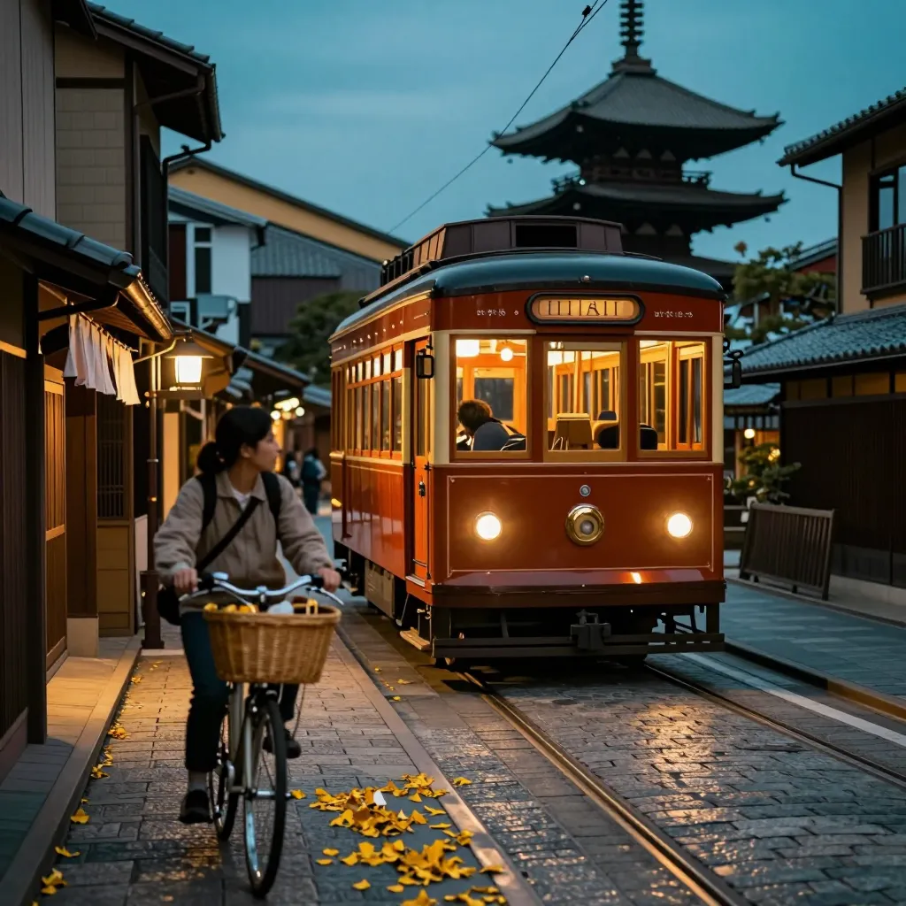
Cycling: The Local's Choice
Kyoto consistently ranks among Asia's most bike-friendly cities, and for good reason. The flat terrain, grid street pattern, and relatively courteous drivers create ideal conditions for two-wheeled exploration. Dedicated rental shops cluster around Kyoto Station, downtown, and Arashiyama, offering everything from basic city bikes to electric-assisted models.
Cycling shines for neighborhood exploration. The path along the Kamo River, the tree-lined streets of the Imperial Palace Park, and the back lanes between Nishiki Market and Gion all reveal themselves more intimately at cycling speed. Many temples and shrines provide bicycle parking, though some charge small fees during busy periods.
Key considerations: Sidewalk cycling is permitted on designated paths but prohibited on busy pedestrian streets in Gion and Pontocho. Helmets are not legally required for adults but are strongly recommended. Lock your bike diligently—theft is rare but not unheard of at major tourist sites.
Walking: The Most Rewarding Mode
Kyoto reveals itself on foot. The city is compact by Japanese standards, and many of its most atmospheric districts—Southern Higashiyama, Gion, Pontocho, Nishiki Market—are best experienced at walking pace. The rectilinear grid of downtown makes navigation intuitive even without a map.
Several districts deserve dedicated walking attention:
- Southern Higashiyama – A continuous trail from Kiyomizu-dera through Ninenzaka, Sannenzaka, and Maruyama Park to Chion-in and Shoren-in
- Arashiyama – The bamboo grove, Tenryu-ji Temple, and the riverside promenade form a natural walking circuit
- Northern Higashiyama – The Philosopher's Path (Tetsugaku-no-michi) connects Ginkaku-ji to Nanzen-ji via a canal-side trail
- Central Kyoto – The Nishiki Market arcade, Teramachi shopping street, and the Imperial Palace outer gardens
Allow extra time for what the Japanese call mayoi—the pleasant disorientation of wandering down a lane that wasn't on your itinerary.
Route-by-Route Recommendations
From Kyoto Station
| Destination | Best Transport | Notes |
|---|---|---|
| Downtown (Kawaramachi/Shijo) | Karasuma Line subway to Shijo | 5 minutes, frequent departures |
| Southern Higashiyama | Karasuma Line to Karasuma-Oike, transfer to Tozai Line to Higashiyama | 20 minutes total |
| Northern Higashiyama | Karasuma Line to Karasuma-Oike, transfer to Tozai Line to Keage | 22 minutes; walk or bus from Keage |
| Kinkaku-ji | City Bus 101 or 205 to Kinkakuji-michi | 40–50 minutes; expect crowds |
| Arashiyama | JR Sagano Line to Saga-Arashiyama | 17 minutes |
| Fushimi Inari | JR Nara Line to Inari | 5 minutes |
| Nara | Kintetsu limited express from Kyoto Station | Faster than JR for non-pass holders |
| Osaka | JR special rapid to Osaka | 30 minutes; Hankyu from Kawaramachi is alternative |
From Downtown (Kawaramachi/Shijo Area)
| Destination | Best Transport | Notes |
|---|---|---|
| Kyoto Station | Karasuma Line subway | Direct, 5 minutes |
| Gion/Higashiyama | Walk east across the river | 15–20 minutes; more atmospheric than transit |
| Kinkaku-ji | City Bus 59 from Kawaramachi-Sanjo | Direct but slow; taxi for groups |
| Arashiyama | Tozai Line to Uzumasa-Tenjingawa, then taxi or bus | Or bus 11 from Sanjo-Keihan |
| Fushimi Inari | Keihan Line to Fushimi-Inari | 15 minutes |
| Osaka (Umeda) | Hankyu Line from Kawaramachi | Direct, roughly 45 minutes |
Seasonal Transport Considerations
Cherry Blossom Season (Late March–Early April) Buses in Higashiyama and Arashiyama become essentially stationary during peak bloom. Prioritize subways and trains, and plan to walk the final segments to major viewing spots. Morning visits (before 9:00 AM) mitigate crowds.
Autumn Foliage (Mid-November–Early December) Similar congestion patterns apply, particularly around Tofuku-ji, Eikando, and the Arashiyama corridor. The Eizan Railway to Kurama and Kibune runs special seasonal schedules but still faces heavy demand on weekends.
Summer Heat (July–August) Walking long distances becomes draining by mid-morning. Shift temple visits to early hours, use air-conditioned subways for cross-city transit, and carry water—vending machines are ubiquitous but not always present in temple precincts.
Obon (Mid-August) and Golden Week (Late April–Early May) Expect reduced bus frequency and crowded trains. Book shinkansen tickets well in advance if traveling to or from Tokyo during these periods.
Ticketing and Passes
For visitors planning extensive transit use, several pass options exist:
- Kyoto City Bus & Kyoto Bus One-Day Pass – Covers flat-fare zones on both bus systems; economical if taking three or more bus rides daily
- Subway One-Day Pass – Unlimited Karasuma and Tozai line use; best for itineraries heavy on subway corridors
- Subway, Bus One-Day Pass – Combined coverage; ideal for mixed-mode days reaching Kinkaku-ji or outlying temples
- Kansai Thru Pass – Multi-day regional pass covering subways, buses, and private railways across Osaka, Kyoto, Kobe, and Nara; worthwhile for multi-city itineraries
IC cards (ICOCA, Suica, PASMO) charge per ride with no daily cap but eliminate the need to calculate fares or carry exact change. They work on all subways, trains, and buses, plus convenience stores and many vending machines.
Practical Tips for Smooth Transit
- Download offline maps before arrival. Google Maps works well for transit routing in Kyoto, but connectivity can be spotty in temple basements and mountain areas.
- Learn your station exits. Major stations like Kyoto Station and Shijo have numerous exits; choosing the wrong one can add ten minutes of backtracking.
- Respect queue culture. At bus stops and train platforms, lines form organically. Cutting or crowding draws immediate disapproval.
- Avoid rush hours (7:30–9:00 AM, 5:30–7:30 PM) when possible. Commuter trains and buses become uncomfortably packed, and taxis are harder to hail.
- Carry cash for rural buses. While city buses accept IC cards, some mountain routes and private lines still require exact fare in cash.
Final Thoughts
Kyoto's transport system mirrors the city itself: layered, historically evolved, and deeply functional once you grasp its logic. The temptation is to over-plan every connection, but some of the city's finest moments come from unplanned transitions—a walk along the Kamo River at dusk, a sudden decision to cycle to a neighborhood café, or the discovery that a temple you hadn't considered is a ten-minute stroll from your hotel.
Start with the subway and trains for efficiency, add buses only when necessary, and never underestimate the power of walking or cycling to transform transit time into travel experience.